New Technologies in Precision Agriculture
Posted on: October 31, 2019
By: Felipe Gonzalez, Aaron Mcfadyen, and Eduard Puig
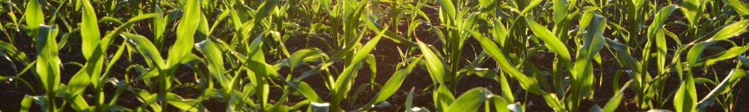
Precision agriculture or precision farming can be defined as the use of spatial and temporal information of crops in order to perform site-specific management. Its main aim is to increase crop yield and farm profitability through a more efficient use of resources.
Conventional farm management techniques are often based on applying uniform quantities of crop inputs, such as seeds, water, fertilizers, pesticides, and herbicides. Precision agriculture however consists of delivering customized inputs based on georeferenced crop information and the partition of fields into zones with particular treatment requirements. With the advent of miniaturized sensor technologies and the ever-increasing number of precision agriculture applications, a variety of agricultural equipment of increasing complexity is progressively being developed.

Variable Rate Technology
Since the 1990s, Variable Rate Technology (VRT), which describes any technology that enables the variable application of inputs, is one of the most popular precision agriculture techniques (Zhang and Kovacs 2012). Some of the most common inputs are fertilizer, pesticides (herbicide, insecticide, and fungicides), manure, seeding, tillage, and irrigation. By optimizing their usage, farm managers can increase productivity while minimizing the environmental and health risks of chemical inputs.

Remote Sensing and Precision Agriculture
Precision agriculture relies on actionable information obtained from sensors and data analysis software in order to achieve efficiency in farm practices. Actionable information is the result of integrating different sources of approximate real-time sensor information into a decision support system. Some of the most common platforms from which the sensors acquire the data include satellites, manned aircraft, unmanned aircraft, tractors, and handheld devices. Remote Sensing (RS) is the science of obtaining information and measuring properties of objects on the Earth’s surface from a distance, typically from aircraft or satellites; as opposed to proximal sensing, which refers to sensor data acquisition from ground vehicles and handheld devices (Mulla, 2013).
Traditional Remote Sensing technologies based on satellite and aircraft platforms are continuously improving in terms of spatial and temporal resolution, thus enhancing their suitability for precision agriculture applications.
The operational success of Variable Rate Technology relies heavily on timely sensor data collection and the accurate computation of prescription maps describing crop vigor, deficiencies, disease, weeds, and pests, as well as soil variables, such as moisture and nutrient content. The data can be obtained in a variety of ways, such as the traditional Remote Sensing platforms described above; more recently other platforms, such as Unmanned Aerial Vehicles (UAVs), or sensors are mounted on vehicles can provide higher sensor proximity to the crops as well as near real-time information.

Unmanned Aerial Vehicles
Unmanned Aerial Vehicle (UAV) generally refers only to the vehicle as a platform including all systems necessary to fly. The term “Unmanned Aerial System” (UAS) is also very common in the aviation industry to refer not only to the UAV hardware but the sensor payload, data processing units, and ground station equipment.
UASs often contain a more cost-effective and flexible sensor platform than satellite or general aviation aircraft, particularly for farm-scale areas up to hundreds of hectares. One of the main advantages of deploying UASs in farm environments is their capability to perform autonomous flights without being actively controlled by a ground-based operator.
UASs represent a technological opportunity for precision agriculture applications by improving safety, reducing liability, increasing accuracy, and saving time and money when used in a systematic and effective way. Their use in agricultural environments is expected to continue to increase in upcoming years. A recent research report published by the Association for Unmanned Vehicle Systems International (AUVSI), concluded that by 2025 agriculture will make up about 80% of the commercial UAS industry (AUVSI, 2015).

New Technologies in Precision Agriculture
Find out more about the latest advances in unmanned aerial systems and payload technologies for precision agriculture, including case study examples with this free chapter download. Also receive a complimentary 20% discount code to use on your next book order from www.crcpress.com.
|
|
|
|
Download Now |
|

Precision Farming and Payload Technologies
To obtain valuable data for precision agriculture applications, it is often necessary to use specialized payloads, as well as an autopilot system to survey a field following a predefined flight path. There are a wide variety of payload technologies currently used for precision agriculture applications with different levels of consolidation and adoption in commercial environments.
Imaging sensors: These measure the radiation emitted or reflected from the object of interest, which in precision agriculture are mostly crops, weeds, and soil. The objective of imaging surveys is to estimate crop attributes at the leaf or canopy level with the reflectance values at various wavelengths. These can provide a spectral signature for healthy vegetation across visible and infrared bands. They can be assigned into the following categories:
-
Visible Spectrum Imaging
-
Multispectral Imaging
-
Hyperspectral Imaging
Non-Imaging Sensors: Volatile organic compounds (VOCs) are emitted throughout the lifecycle or plants. Different compounds are emitted from leaves and stems depending on plant species, growth stages, and relative health condition. By measuring VOCs emitted from healthy plants and those under stress, it may be possible to distinguish between various diseases and provide early stress detection. It can be considered a maturing technology that provides a relatively reliable and non-invasive approach to detection and monitoring.
The difficulty arises due to the way in which samples must be taken, and the weight of the compounds to be sampled. As such, this type of sensor may be better suited to ground robots that could perhaps work in coordination with UAVs. Alternatively, the sensor could be suspended and a slow, hover-like flight would be required to move through the field and obtain reliable measurements.

The Future Impact of Farming Technology
As precision agriculture practices are increasingly becoming a more cost-effective approach to improving crop productivity, farm managers are called to adopt new technologies and become more competitive. Precision agriculture practices involve using only the necessary volumes of inputs such as water, fertilizers, herbicides, and pesticides, which helps reduce costs but also minimizes the ecological impact of chemicals on the soil, aquifers, and rivers. The product cycle of a precision agriculture application generally consists of data collection, the development of prescription maps, and delivering custom input applications.
Farm managers and agricultural consultants are slowly adopting UAV technologies led by a sharp increase in research publications by universities worldwide. UAVs provide an aerial platform for specialized sensors to collect aerial data, and often represent a cost-effective alternative to manned aircraft and satellite imagery. Additionally, UAVs have can also be deployed with spraying mechanisms to deliver custom volumes of input in predefined locations over the crop.
The use of UAVs for remote sensing, has reached a relatively high level of maturity. By acquiring aerial imagery with multispectral and hyperspectral sensors, the farmer can obtain quantitative information of the crop. As these sensors can collect spectral information in multiple bands, it is possible to generate maps of crop vigor, nitrogen content, chlorophyll content, and many other crop properties. Also, the use of thermal sensors provides valuable information on the moisture content in the crops and soil, which can be used to optimize the use of irrigation.
The UAS market is growing internationally and many companies are focusing on developing integrated UASs for agriculture that will meet the need to simplify the adoption of this technology. As single-board computers become small, lighter, and more powerful, it will become possible to process the data onboard the UAV, practically delivering real-time, actionable information for immediate farm management actions.
From a technological perspective, the introduction of precision agriculture represented an important step towards managing a farm, based not only on experience but also on actual quantitative information. Subsequently the introduction of GPS-guided VRT trv vactors and more recently the expansion on the use of UASs, reflect the fact that farming practices are gearing towards a fully-automated industry. The farm of the future is likely to present ground and air vehicles that will monitor the crop and communicate with each other to efficiently perform the necessary tasks. In order to remain competitive, humans may no longer be required to execute manual labor but progressively will become supervisors and controllers of technology systems.
This article was cited from Agricultural Machinery and Technologies, Edited by Guangnan Chen.
|
|
|
|
|