

1st Edition
Understanding Hydrological Variability for Improved Water Management in the Semi-Arid Karkheh Basin, Iran UNESCO-IHE PhD Thesis
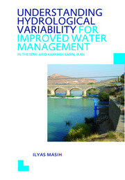
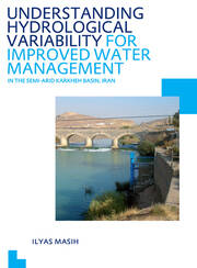
This study provides a hydrology based assessment of (surface) water resources and its continuum of variability and change at different spatio-temporal scales in the semi‑arid Karkheh Basin, Iran, where water is scarce, competition among users is high and massive water resources development is under way. The study reveals that the ongoing allocation planning is not sustainable and essentially requires reformulation, with consideration of spatio‑temporal variability and observed trends in the streamflows regarding flood intensification and decline in low flows.
The development of innovative methods for quantification of the hydrological fluxes (i.e., regionalization of model parameters based on similarity of the flow duration curve and the use of areal precipitation input in the hydrological modeling) helped better understanding and modeling the basin hydrology. The investigation of scenarios for upgrading rain-fed areas to irrigated agriculture, using SWAT, recommends the promotion of in-situ soil and water conservation techniques. Conversion of rain-fed areas to irrigation causes significant reduction in the downstream flows, and requires additional considerations such as less development in the upper catchments, practicing supplementary irrigation and developing water storage. The knowledge generated is instructive for hydrological assessment and its use in water resources planning and management in the river basin context.
1. INTRODUCTION
1.1. Background
1.1.1. Increasing pressure on earth’s water resources
1.1.2. Adapting sustainable solutions
1.1.3. Managing water by river basin
1.1.4. Need for a hydrological synthesis
1.2. Hydrological and Water Management Issues in the Karkheh Basin, Iran
1.2.1. An overview of the water issues of Iran
1.2.2. Description of the Karkheh Basin and problem statement
1.3. Research Framework
1.3.1. Research motivation
1.3.2. Research objectives and questions
1.3.3. Contribution of the proposed research
2. MATERIALS AND METHODS
2.1. Methodological Framework
2.1.2. System investigation
2.1.3. Hydrological modeling
2.2. Data Collection
3. STREAMFLOW VARIABILITY AND WATER ALLOCATION PLANNING
3.1 Introduction
3.2. Data and Methods
3.3. Results and Discussion
3.3.1. Spatial and temporal variability of daily streamflow regimes
3.3.2. Spatial and temporal variability of monthly streamflows
3.3.3. Long-term variability in annual surface water availability
3.3.4. Overview of the basin-level water accounting
3.4. Concluding Remarks
4. STREAMFLOW TRENDS AND CLIMATE LINKAGES
4.1. Introduction
4.2. Data and Methods
4.2.1. Hydrological and climate data and indices
4.2.2. Trend and correlation analysis
4.3. Results and Discussion
4.3.1. Characterizing the streamflow regime
4.3.2. Streamflow trends
4.3.3. Trends in the climatic data
4.3.4 Streamflow trends and climate linkages
4.3.5 The impact of NAO index on the local climate
4.4. Concluding Remarks
5. REGIONALIZATION OF A CONCEPTUAL RAINFALLRUNOFF MODEL BASED ON SIMILARITY OF THE FLOW DURATION CURVE
5.1. Introduction
5.1.1. Problem statement
5.1.2. Review of regionalization methods using conceptual rainfall-runoff models
5.1.3. Scope and objective
5.2. Materials and Methods
5.2.1 Study catchments and available data
5.2.2 Naturalization of the streamflows
5.2.3. Model calibration and validation at the gauged catchments
5.2.4. Regionalization of model parameters based on catchment similarity analysis
5.2.5 Assessment of the impact of parameter uncertainty on the regionalization results
5.3. Results and Discussion
5.3.1. Model results of automatic parameter estimation
5.3.2. Regionalization results based on drainage area, spatial proximity and catchment characteristics
5.3.3. Regionalization results based on FDC
5.3.4. Impact of parameter uncertainty on the regionalization results
5.3.5. Comparison of the FDC- based regionalization results with other studies
5.4. Concluding Remarks
6. IMPACT OF AREAL PRECIPITATION INPUT ON STREAMFLOW SIMULATIONS
6.1. Introduction
6.2. Data and Methods
6.2.1. Data used in the model setup
6.2.2. Formulation of precipitation input scenarios
6.2.3. Model calibration
6.3. Results and Discussions
6.3.1. Comparison of precipitation input
6.3.2. Comparison of streamflow simulations
6.4. Concluding Remarks
7. QUANTIFYING SCALE-DEPENDENT IMPACTS OF UPGRADING RAIN-FED AGRICULTURE
7.1 Introduction
7.2. Methodology
7.2.1. Model used for the scenario simulation
7.2.2. Tested scenarios
7.3. Results and Discussion
7.3.1. Downstream impact of upgrading rain-fed areas to irrigated agriculture (S1)
7.3.2. Downstream impact of improved soil water availability through rainwater harvesting Scenario (S2)
7.3.3. Combined impact of S1 and S2 (S3)
7.3.4. Consideration of prediction uncertainty of the model
7.4. Summary and Concluding Remarks
8. SYNTHESIS, CONCLUSIONS AND RECOMMENDATIONS
8.1. Nature and Causes of a High Level of Hydrological Variability
8.2. Water Allocations, Water Availability and Sustainability
8.3. Streamflow Trends and Their Underlying Causes
8.4. Addressing Methodological and Data Scarcity Issues in the Hydrological Modeling
8.5. Consideration of the Impacts on Downstream Water Availability while Upgrading Rain-fed Agriculture
8.6. Contribution and Innovative Aspects of This Research
8.7. Major Recommendations and Future Directions
Biography
Ilyas Masih
