


1st Edition
Developing Spatial Data Infrastructures From Concept to Reality
Expert perspectives on SDI theory and practice
The spatial data infrastructure (SDI) concept continues to evolve and become an increasingly important element of the infrastructure that supports economic development, environmental management, and social stability. Because of its dynamic and complex nature, however, it remains a fuzzy concept to many, and depending on their needs and circumstances, practitioners, researchers, and governments adopt different views of it.
Developing Spatial Data Infrastructures: from Concept to Reality makes a timely contribution to the theory and practice of SDIs and breaks new ground in improving understanding of their relevance and value. It provides expert overviews of policies, concepts, standards, and practices associated with the design, implementation, and operation of SDIs. It introduces the concept of an SDI Hierarchy based on Hierarchical Spatial Reasoning, sets out the similarities and differences between SDIs operating within and between different jurisdictions, and identifies factors key to the success of SDI initiatives.
Built on key contributions to the International Symposium on Spatial Data Infrastructure held in Melbourne in November 2001, this book is the first of its kind to provide address both the theoretical and practical aspects of developing appropriate SDIs. It offers unique, detailed discussions on the challenges and direction of future SDI development and thus provides an outstanding resource for those involved in building and maintaining SDIs and for GIS professionals and students.
SDIS- SETTING THE SCENE
Building Spatial Data Infrastructures
Challenges Facing SDI Development
Conclusion
References
SPATIAL DATA INFRASTRUCTURES: CONCEPT, NATURE AND SDI HIERARCHY
The Need for Spatial Data
Spatial Data Infrastructure
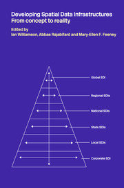
SDI Hierarchy
Applying Hierarchy Theory on SDIs
Relationships among Different SDIs
Conclusion
References
PART TWO:FROM GLOBAL SDI TO LOCAL SDI
GLOBAL INITIATIVES
Global SCI-GSDI
Global Map
References
REGIONAL SDIS
European Umbrella Organization For Geographic Information (EUROGI)
Permanent Committee On GIS Infrastructure For Asia And The Pacific (PCGIAP)
Permanent Committee On Spatial Data Infrastructure For The Americas (PCIDEA)
Comparative Evaluation
References
SDI DIFFUSION - A REGIONAL CASE STUDY WITH RELEVANCE TO OTHER LEVELS
Asia and the Pacific Region and Regional SDI Activities: A Case Study
SDI Diffusion
Influencing Factors for Regional SDI Diffusion
SDI Development Models
New Strategies and Future Directions
Conclusion and Recommendations
References
NATIONAL SDI INITIATIVES
National SDI - The Ceoncept and Nature
Role and Relationships within SDI Hierarchy
Generaltional Development of SDIs
Recommendations and Future Directions
References
STATE SDI INITIATIVES
The Nature of Spatial Information at a State Level
State SDI - Organizational Issues
The Operation of State SDI
Partnerships in State SDI
Evaluation of State SDI Initiatives
Other Issues and Future Directions of State SDI
References
PART THREE: AUSTRALIAN CASE STUDY FROM NATIONAL TO LOCAL
DEVELOPMENT OF THE AUSTRALIAN SPATIAL DATA INFRASTRUCTURE
ANZLIC - The Spatial Information Council
ASDI Conceptual Model
ASDI Implementation
Current Issues And Future Directions
References
STATE SDI DEVELOPMENT: A VICTORIAN PERSPECTIVE
State SDI in Victoria
Linages to the National Spatial Information Sector
Ke State SDI Initiatives
Victoria's SDI: Next Steps
Conclusion
References
SDI DEVELOPMENT: ROLES OF LOCAL AND CORPORATE SDIS
Local SDI Development at Geelong
Corporate SDI in Multi-Level SDI Development- The Case of DNRE
Some Patterns of SDI Development
Conclusions
References
SUSTAINABLE DEVELOPMENT, THE PLACE FOR SDIS AND THE CASE FOR E-GOVERNANCE
The Effect on Government
The Role for SDIs
The Case for E-Governance
Conclusion
PART FOUR: SUPPORTING ECONOMIC, ENVIRONMENTAL AND SOCIAL OBJECTIVES
SUSTAINABLE DEVELOPMENT, THE PLACE FOR SDIs AND THE POTENTIAL OF E-GOVERNANCE
Sustainable Development
SDIs for Sustainable Development
The Potential of E-Governance
Conclusions
References
SDIs AND DECISION SUPPORT
Decision Support for Sustainable Development
Spatial Decision Support and SDIs
Supporting the Decision Evironment
The Developing Decision Support Status of SDIs
Decision Support in the Future of SDIs
References
FINANCING SPATIAL DATA DEVELOPMENT: EXAMINING ALTERNATIVE FUNDING MODELS
The Economic Issues of SDI Implementation
The Concept of SDI Funding Models
Alternative Funding Models
Customizing the Alternative Funding Models for Emerging Nations
Discussion
Conclusion
References
DEVELOPING EVALUATION AND PERFORMANCE INDICATORS FOR SDIS
Land Administration Systems and the Role of SDIs
Evaluation And a Framework for Evaluation
Evaluation of SDIs
Conclusions
References
PART FIVE: TECHNICAL DIMENSION
ADMINISTRATIVE BOUNDARY DESIGN IN SUPPORT OF SDI OBJECTIVES
A Definition of the Spatial Hierarchy Problem
Administrative Boundaries within SDI
Conclusion
References
SDI AND LOCATION BASED WIRELESS APPLICATIONS
SDI as a Foundation for Location Based Services
Augmenting the SDI Model
Framework to Facilitate Wireless Applications
Case Study
Discussion, Recommendations and Future Directions
References
POSITIONAL FRAMEWORKS FOR SDI
SDI and Positional Accuracy
Opening the lid on Geodesy
Spatial Data Referencing
Transforming Between Different Reference Frames
Measuring and Recording Positional Accuracy
Case Studies
Conclusions
References
PART SIX: FUTURE DIRECTIONS
FUTURE DIRECTION FOR SDI DEVELOPMENT
Covering the SDI Landscape
SDI Development Issues
Conclusion
References
Biography
Professor Ian P. Williamson, is the Professor of Surveying and Land Information, Head, Department of Geomatics, and Director, Centre for Spatial Data Infrastructures (SDI) and Land Administration, at The University of Melbourne. His teaching and research is in the areas of cadastral, land and geographic information systems, land administration and SDI and he advises state and federal government, UN agencies and The World Bank in these areas. He was Chairperson of Commission 7 (Cadastre and Land Management) of the International Federation of Surveyors 1994-98, and is the current Director for United Nations Liaison for the FIG. He is also Chairperson of Working Group 3 (Cadastre) of the United Nations-sponsored Permanent Committee on Geographic Information Systems Infrastructure for Asia and the Pacific 2001-2004.
Dr Abbas Rajabifard, is Deputy Director of Centre for SDI and Land Administration, and a Research Fellow in the Department of Geomatics, The University of Melbourne. He holds PhD (Melb), MSc (ITC), Postgrad-Dipl (ITC), and BSurv (Tehran). He worked for the National Cartographic Centre (NCC), Iran (1990-98), where he was Head of the GIS Department, managing the National Topographic Database and National GIS in Iran. From 1994-1999 he has been an Executive Board member and National representative to the Permanent Committee on GIS Infrastructure for Asia and the Pacific (PCGIAP). Since then he has been an active member of WG2 and is now Research coordinator in PCGIAP-Working Group 3. He has also been a member of the International Steering Committee for Global Mapping 1997-2001.
Ms Mary-Ellen F. Feeney, is completing her PhD at the Centre for SDI and Land Administration, The University of Melbourne. She is involved in lecturing, tutoring and course development in a number of subjects and has research interests in the development of SDI to support decision making at local through national levels. She is a member of the Global SDI and Decision Support System (DSS) Working Group. She holds BSc App.Geog.(Hons) (NSW), completing her research with the Commonwealth Science and Industry Research Organisation (CSIRO) and University of NSW in 1997. She has held positions as CSIRO Research Assistant (1996-1997), Australian Hydrographic Service Cartographer (1998) and Technical Development Officer (1998-1999), and has been involved in the development of the Australian Digital Hydrographic Database, GIS infrastructure and capacity building for the Department of Defence.
